How old is Haarlem? Mapping buildings by age
November 13, 2025
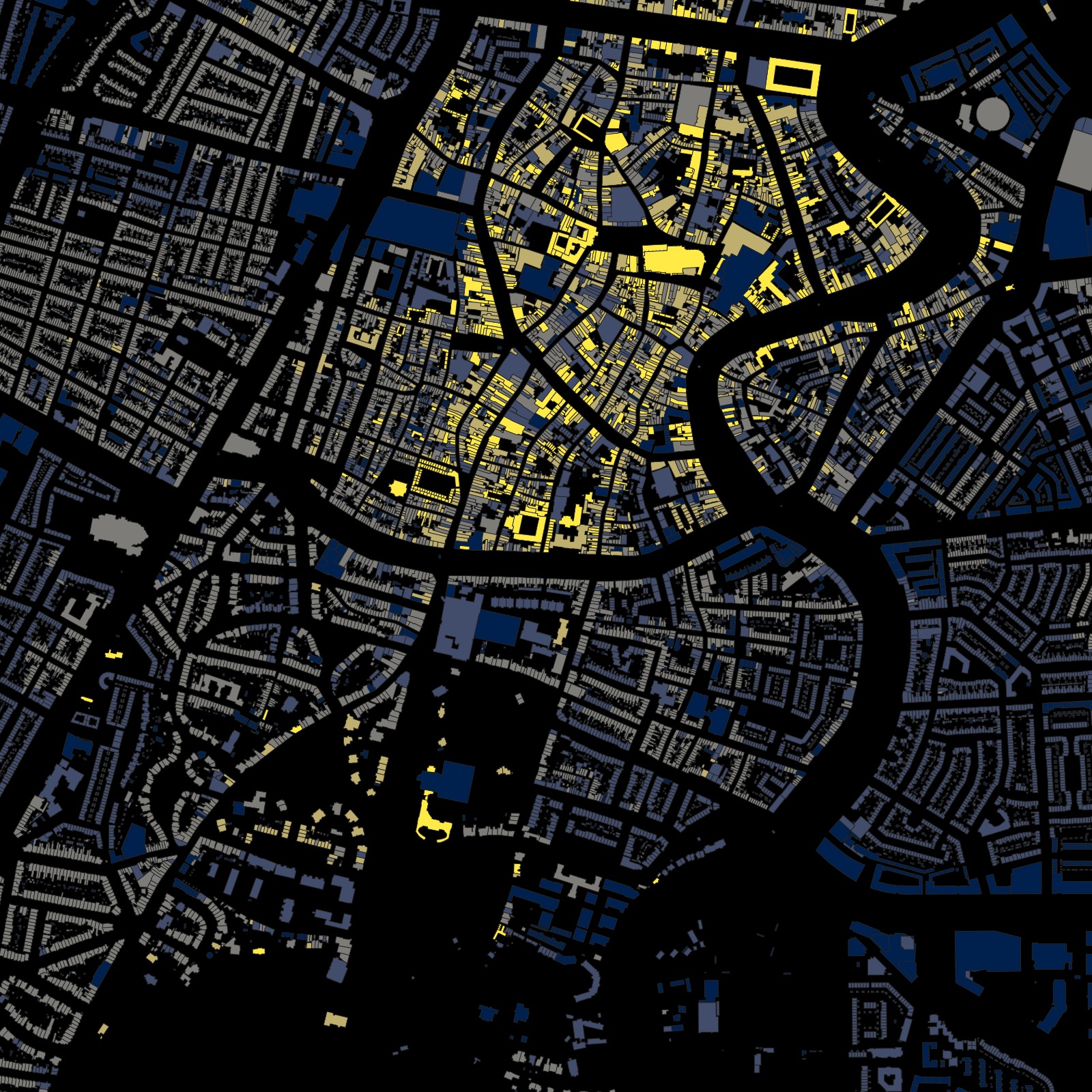
Day 13 of #30DayMapChallenge looked at building age. Using the Basisregistratie Adressen en Gebouwen (BAG), I painted Haarlem by build year to show how the city grew outward.
Data and styling
- Dataset: BAG building footprints with construction year.
- Binned years into rough eras: pre-1850 cores, 1850–1918 expansion, interwar fill, postwar growth, and contemporary infill.
- Styled as a simple categorical map so the center pops dark and the ring roads glow newer.
Street name themes
Alongside the building ages, I also mapped the dominant street name themes in small grid cells across the city. Each square shows which naming theme is strongest in that area.
The first image highlights areas where street names cluster around churches and religious references. These tiles tend to sit close to older neighborhoods and historic centers where parish life shaped the local grid.

The second image surfaces water themed streets. Here the dominant names refer to canals, rivers, harbors, or water related work, and you can see them hugging the Spaarne and the old waterfront corridors.

The third image shows tiles where military, overseas, or colonial references dominate the street names. These clusters often sit in later expansions where planners borrowed names from regiments, battles, or far away places instead of local landmarks.

The classification is quick rather than archival. I had one day for the entire process, from data extraction to visualization, so it is not historically precise enough to use as a source. Even so, the three maps already reveal patterns and clusters that might be worth a closer, slower pass later.