Deforestation in Rondônia, Brazil: mapping burn scars
November 15, 2025
Day 15 of #30DayMapChallenge focused on fire. I pulled a stretch of Rondônia, Brazil where pasture expansion and dry-season burns repeat every year, then mapped how much vegetation the latest burn actually removed.
Workflow
- Grabbed two Sentinel-2 scenes: pre-fire (Aug 18, 2023) and post-fire (Sep 22, 2023).
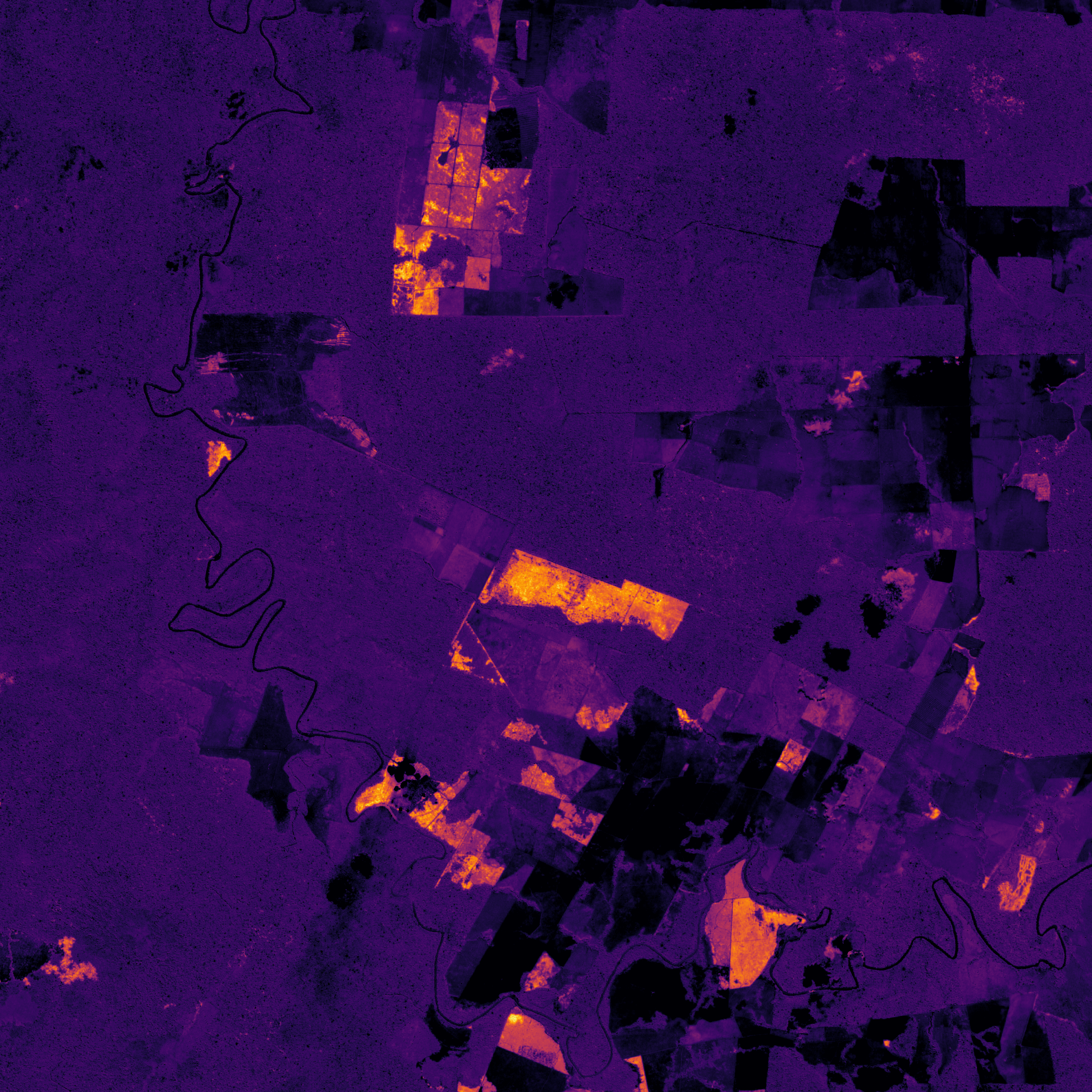
- Converted the raw bands, aligned NIR (B08) and SWIR (B12), and computed NBR for both dates.
- Calculated dNBR to isolate burn severity; masked smoke/cloud where the index collapses.
- Built a quick pre/post swipe plus a severity layer so you can see the scar rather than just the RGB farmland.
What looks like clean, organized blocks from above fractures under the index: old clearings, new clearings, regrowth, and fresh scars from dry-season fires. The bright dNBR zones are the hardest-hit areas; the dark speckled zones are either minimal loss or places where the data was unusable.
Why it matters
Pasture expansion here is not a single event. It is a pattern of clearing, burning, and re-burning that erodes the surrounding forest edge. Pairing a visible RGB swipe with the severity layer makes it harder to mistake order for stability.